 | |
12th February.
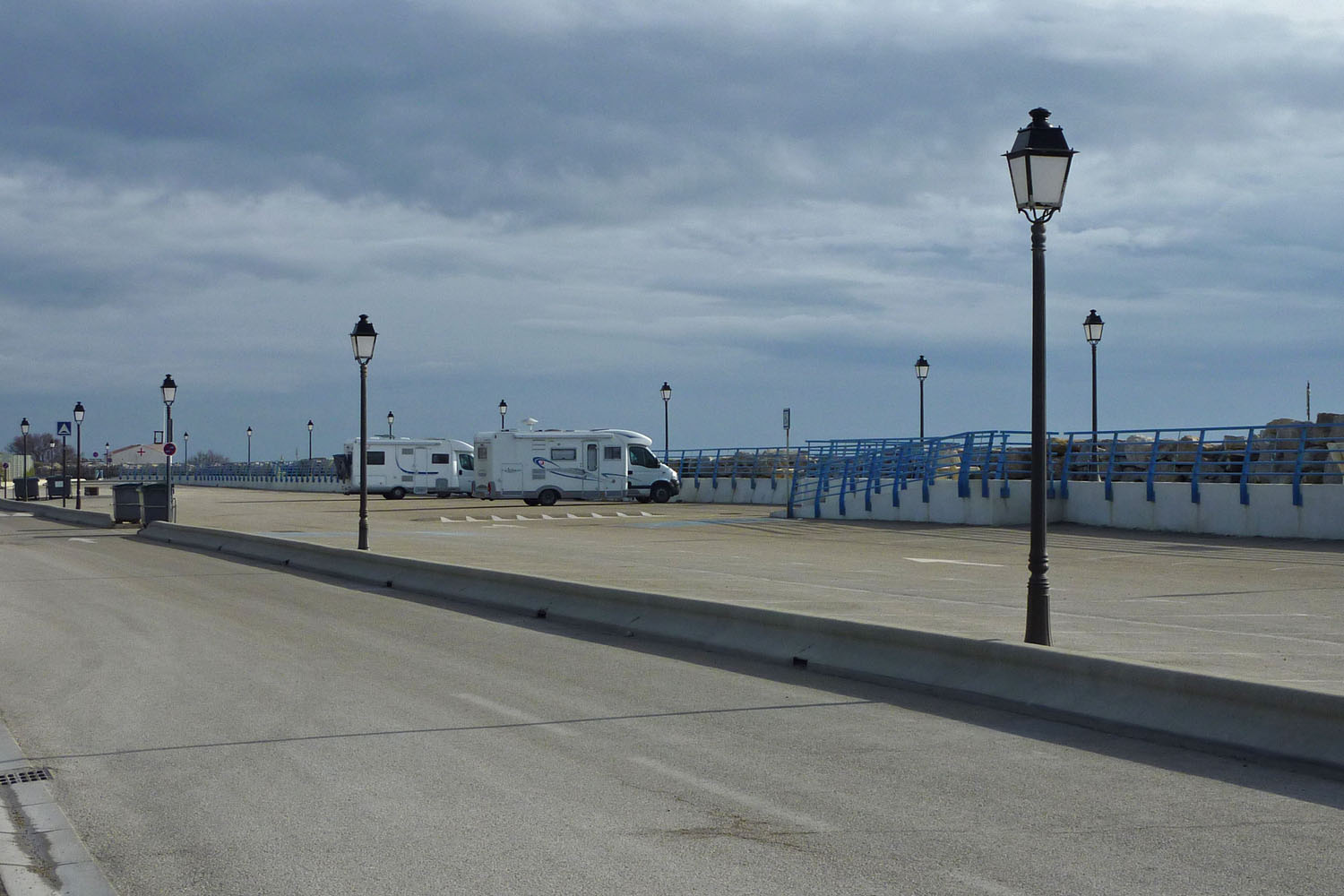
After our late evening arrival in Port Saint Louis, and just a slightly disturbed night on the marina quay, I tip-toed out of the van into some welcome sunshine. 20 metres behind us was a customs launch that had rumbled past in the early hours before mooring up!
 |
| Seemed like a quiet spot before the customs launch arrived! |
At the end of the jetty was the drolly named “Ship of Fools” with some comical appendages in prominent places, for example, a huge knife, fork and spoon as a figurehead!
 |
| Ship of Fools - have I been here before? |
The Capitanerie in Port Saint Louis is undergoing a major rebuild and will soon be open with a clubhouse for the marina’s yachties and “Services Plaisance” - often handy for a launderette.
On the quay was a regular small fish market under an artistic steel and canvas sun shade, doing good business with a wide selection of fish and crustaceans. Another few minutes walk away was a large Intermarche with filling station.
Maybe Port St Louis makes a good starting off point for an exploration of the Camargue!
 |
| Our trail around the Camargue |
(Microsoft AutoRoute 2010, GPS track: Globalsat BT 338X Data logger)
After breakfast we drove around the corner - to find the rest of the parked up motorhomes we had spied earlier from the deserted aire across the water! Well ensconced all along the grassed-over harbour's edge, they were there mainly for the fishing apparently.
What struck us most about Port St Louis was not only the huge harbour, but the vast amount of derelict land, abandoned industrial buildings, cargo handling and refuelling infrastructure. The loss to the local economy must have been shattering - where did it all go?
Now all they have is a couple of moderate size marinas, a small fishing fleet and some new, mostly unoccupied blocks of holiday apartments. It's gratifying to see the money being spent to transform the town for a new century, but they have a long, long way to go.
So, to the Camargue proper, the Regional Nature Park. The Bac de Barcarin or ferry across the Grand Rhone to Salin de Giraud costs 5 euros - paid on board. We timed it right for a change and were over in minutes.
 |
| Ferry across the Rhone |
Turning south almost immediately onto the D36d, we headed for the Plage Piemanson. You actually drive right alongside the banks of the Rhone, and there are some stopping off points to gaze at this huge river and its life.
We passed a salt works, with heavy machinery for scooping up the evaporated salt from the marsh, plus the most enormous mountain of salt left out in the open. Not sure I'd fancy any of that for my fish and chips! (Actually it is all thoroughly washed - yes, washed - in clean sea water before packing for sale)
At the end of the road is a big gravel car park, no signs banning motorhomes or the like, just a few waste bins.
The sun was now out in strength and we sucked in the cool sea air and the wonderful light. The only other person around was a motorhomer, standing on the shore of the lake with a powerful telescope on a tripod, taking pictures of wading birds with an attached camera.
Across from the car park is the vast, sandy Piemansion Beach, looking out to the Mediterranean.
 |
| Car park for Piemansion beach, looking onto the adjacent lake |
We could easily have lingered longer, but felt there was much more to see. We took a quick look at the Domaine de la Palissade nature reserve. Here there is a helpful tourist office, a pleasant picnic spot, several walking trails and an equestrian trail that takes the visitor into the wetlands.
GPS: 43.3758 N, 04.8103 E
www.conservatoire-du-littoral.fr
Back up at Salin de Giraud, we found the promised aire around the back of the fire station, also several French vans parked up. One lady advised me that the fresh water stands were still shut off for the winter, though if you were willing to use a canister, the toilet cassette rinse did have a supply.
From the bottom of town we headed off for Faraman and La Béluge, but at Faraman the road was "Route barrée" and we had to retrace our steps, taking the D36c out of Salin de Giraud.
We drove as far as we could to the Phare de la Gacholle, where there is limited parking and a causeway to the actual lighthouse 12 km away. The sign says: "light vehicles only in dry weather, no 4x4's" – so I guess that excludes motorhomes!
A nice rough-track cycle ride however, sea water lagoons on either side. Admission is free to the lighthouse and there is an exhibition on the Camargue coast.
La Capelière is another individual nature reserve with an information centre, walking trails, hides and observation points - opening times and access to some of the hides are more restrictive though.
www.reserve-camargue.org
Just after La Capelière, heading north, there is a large layby and viewing platform for the mighty Etang du Vaccares, which seemed a good place to stop for the night.
It's no easy matter getting to the waters edge however, most entrances are gated or fenced off with "no hunting" signs, but I did find one open to get amongst the reeds. Making my way back to the road I nearly had a heart attack when I heard dogs barking and the thunder of heavy paws on the narrow track! Fortunately they were family dogs and took not the blind bit of notice of me.
 | |||
| Worth the scramble through the reed beds! |
 |
| Sun sets fire to the reeds |
 |
| Go to sleep now |
The road was quiet after dark, and apart from one vehicle sounding their horn as they went by, we had a peaceful night in the company of a large 'A' Class van.
Ah, the joys of travelling off season.
13th February
As a misty morn dawned we watched Black headed Gulls, Egrets and ducks feeding at the waters edge.
The weather wasn't great so our next stop was the Museum of the Camargue, installed in a former sheep barn on the Pont de Rousty farmstead. Alongside runs the Canal du Rousty, constructed in 1543 and used to drain the marshes and cultivated land. Excess water is pumped into the Rhone, or in exceptional circumstances allowed to gravitate to the Etang du Vaccarés.
 |
| The Canal du Rousty |
Black bulls and White horses are the traditional icons of the Camargue, along with the gaucho or Gardian, and are inextricably linked because of the use of horses to manage the bulls.
The Pink Flamingo and Egret now pop up regularly too on publicity material and roadside signs.
A new emblem was created by a local artist that they call “The Cross of Camargue” - combining a cross tipped with the tridents of the Gardians (for faith) an anchor (for hope) and a heart (for charity). Quite a neat design I suppose, and they seem to be proud of it.
 |
| Three ages of the Camargue Gardian |
The topography of the Camargue is varied and very complex - today the equilibrium of all its aspects is managed by man with protective dykes, pumps and sluice gates. It can be categorised into 3 or 5 different environments, depending on whose material you are reading!
In the upper Camargue and the banks of the Rhone are the Fresh Water Marshes and Reed Beds. The marshes are home to aquatic plants such as bulrushes, cane and reeds, and in summer are used as pasture, also for hunting birds and mammals.
In the winter they provide shelter for nesting and wintering birds, and the reeds are harvested for roofing.
 |
| An Egret feeds by the reed beds |
In the lower Camargue, along with 50km of sandy beaches, are the Sansouires or Salt Plains. They are sometimes flooded, but dry out in the intense summer heat - salt concentrations rising up to the surface, producing a white film. Only a few plants such as salicorne are salt tolerant enough to survive.
Then there are Salt Meadows, fragmented environments, with clovers and grasses which complete their life cycle before the summer drought - and the land dries hard as stone.
The Salt Ponds or Etangs are former branches of the Rhone delta that have become silted up and separated by sand bars from the sea. The levels are controlled by sluice gates to the sea, but the concentration of salt varies from year to year.
The lagoons are rarely more than a metre deep and are interconnected by natural channels. The lower ponds provide a refuge for bird life, famously the Pink Flamingo, but are also important for fish and water resource management.
 |
| Pink Flamingos in the salt lagoons |
Finally, there are the Salt Marshes, managed by man to maximise the concentration of sodium chloride in the water - the Sauniers and their equipment producing salt for human and industrial consumption.
The salt marshes are rich in invertebrates, making them a favourite habitat for the pink flamingo.
 |
| Heavy machinery is used to harvest the evaporated salt |
Accessible from the Camargue museum is a 3.5km nature trail walk showing the environment of a typical Camargue farm. There is a good bird hide and several other interesting installations designed to capture children's imagination, but full of interest just the same.
GPS: 43.6243 N, 04.5293 E
www.parc-camargue.fr
As the weather had closed in after the walk, we elected to stay in the car park overnight, it is well off the main road and access to the trail is open all the time.
14th February
We awoke to heavy rain, so it seemed a good day to use up our inclusive entry tickets for the Arles Musée départmental Arles antique, the collection of all the Roman treasures and artefacts recovered from the area. Housed and meticulously presented in a modern purpose built Museum, they trace the history of the region from Prehistoric times to the end of the Roman Empire.
Musée départmental Arles antique
GPS: 43.6717 N, 04.6179 E
Parking is pretty limited nearby for a motorhome - mainly on the roadside, but fortunately we were allowed to use the bus and disabled car park after asking at reception.
In you're into beautifully decorated sarcophagi (strangely, Sue seems to have developed an particular interest) you'll be in metaphorical heaven as there are dozens of the carved stone coffins.
But, for me the fantastic architectural models of the Roman Theatre, Amphitheatre, Circus and others, were more engaging, revealing not only the complete form of each edifice to enrich your imagination of the original, but also their complexity, and the genius of the Roman design for terraced arenas housing up to 20,000 people.
 |
| Magnificent model of the Roman Theatre |
Some of the carved heads and decorative statues retrieved from the ruins of the theatre are exquisite in their execution - was it a lifetime's work to achieve such a level of artistry?
The sheer scale of Roman construction also boggles the imagination - amongst all the public arenas and municipal facilities they built, there is a model of a terraced, water driven flour mill that produced 4.5 tonnes of flour a day!
One exhibit is stacks of lead water main pipes, each 4 metres long and 100 mm in diameter - literally tonnes of them, how did they make all that stuff?
Finally, in a special hall was a display of recently recovered artefacts, including a bust of Julius Caesar recovered from the murky depths of the Rhone! A film recounts the discovery, the cleaning and preservation, and a battery of high-tech techniques that the ancient stone head was bombarded with.
 |
| Julius Caesar, looking remarkably well after a 1000 years or more at the bottom of the Rhone |
Before heading down to the main Camargue resort of Saintes Maries de la Mer, we pumped n'dumped at the city aire - free water.
Aire, Arles
GPS: N 43.6817 04.6305 E
Driving down the D570 at Avignon is the Chateau d'Avignon, the vineyard of Louis Prat, who made the famous Noilly Prat apertif in Marseille. Opening is restricted to Fridays off season and advance booking is required.
At Pont de Gau there is a Bird park with a series of trails, paths and observation points amongst the marshes. Open every day, until sunset.
As you approach Saintes Maries del la Mer, there are endless Mas or farms proclaiming horse rides, bull displays, all manner of provisions and sustenance and even discotheques!
Mary Magdalene is recorded as having landed ashore there in exile in AD 44, along with Mary Jacob-Cleophus and Mary Salome-Helena. Hence the spot became a place of pilgrammage, and Saintes Maries de la Mer took its name from the "Saint Marys".
There are two main overnight aires in town, one on the main road coming in, and then the Parking Plage Est on the beach front, behind a sea wall. Both are 9.50 Euro and the water availability is limited during the day. We elected for the one on the sea front. Some salt spray from the breaking waves, but altogether a nicer ambience. Water is only available from 0900 to 1200, fees are collected around 0830.
Valentine’s day dinner was an “in house” affair!
 |
| Parking Plage Est, behind the sea wall |
Aire, Saintes Maries del la Mer
GPS: 43.4540 N, 04.4382 E
15th February
At last a significant temperature rise and some decent sunshine to go with it. We got on the bikes and rode along the seawall into town. Extensive defences against erosion have recently been constructed, using hundreds of tonnes of rough stone, creating miniature sandy bays.
On the waterfront is a small bullring, now used (at least in part), as a boat store. We watched a few professional fishermen preparing for sea, rode up to the marina and then into the town centre.
 |
| The bull breaks through at Saintes Maries |
Why is it that everywhere we go is getting a makeover? All the central streets were dug up and virtually impassable as they were busy laying large swathes of coloured concrete.
Most of the tourist shops and restaurants were still shut, but we had a look at the distinctive Church. Newly restored outside, inside the stonework is still blackened from centuries of flickering candles, but artfully and impressively lit using modern technology.
Sue was pursued by some fortune-telling ladies who were a bit too persistent for her liking. Remember that phrase? : “What part of NO! don’t you understand!”
Lunch was in the Baraka Cafe which served up a very acceptable tagine with a smile, for 10 Euro a head.
16th February
Driving up the D85a from Saintes Maries, there are several good deep laybys from where you can watch the wildlife, particularly the colourful flamingos.
We then turned back down the D38 - more built up, but still good views of the landscape and an imposing view of the Church on the sweep back into Saintes Maries.
Finally, we ventured into the Petite Camargue, after crossing the Petit Rhone. The D85 down through Pin-Fourcat to the car ferry at Le Point Sauvage has another feel again, more overtly agricultural, and we were treated to some frolicking from some camargue horses.
Mas de Pin-Fourcat is a private estate said to show an authentic and well preserved view of Camargue life. Pre-booked tours in carts or on horseback show the activities of bull and horse breeders, plus glimpses of wild life on marshes and ponds.
www.maspinfourcat.com
The Bac Sauvage is a free car ferry which runs all year, but has a 2 tonne weight limit, thus excluding motorhomes.
 |
| The iconic White Camargue Horse |
Time to leave, and heading towards Aigues-Mortes - out of the boundaries of the Camargue Nature Park - we were suddenly jettisoned back into the ugly, noisy realities of modern life and immediately felt we wanted to be back in the reserve. That says something for its largely unspoilt and coveted charm.
However, you can only really explore the reserve fully on foot or horseback. There are any number of equestrian centres but are mainly concentrated around Saintes Maries.
There are cycle trails, but most are of the 20 - 40 km variety and require a mountain bike.
The walking-trail reserves are ok, but some are so intensively contrived it's hard to feel like an explorer. The signs to "keep quiet" and "use your ears and eyes" seem at odds with the ingenious installations designed to involve and (loudly) excite the kids!
We got the most pleasure from using the van as a hide on roadside laybys - as ever, the best times are early morning and the hour or two before sunset.
The main tourist base is at Saintes Maries, and by the sheer scale and number of the facilities, its quite easy to imagine the mayhem in peak season. Just the few days of warmer weather we had enjoyed latterly, brought out Motorhomes in good numbers.
 |
| The "Cross of Camargue" |
Off season, we managed a few wild/free nights while the campsites where closed, but once they are open I'm sure wayward motorhomes will be herded to them and the aires. All the old tracks and large pieces of waste ground that we saw have now been fully secured and signed against such activities.
We certainly preferred the area of the reserve east of the Etang de Vaccares, it is larger, quieter and less developed. The aire at Salin de Giraud makes a good base. Also there is the only decent roadside access to the Etang du Vaccarès on this side, plus the trails at La Capeliere and Domaine de la Palissade, and the magnificent Plage de Piemansion. Not forgetting the rice and salt museums at Le Sambuc and Salin de Giraud respectively.
The main Camargue museum at Mas du Point de Rousty is a must.
 |
| Gardians Cabin - high roof to deflect the rain, rounded end to face the mistral |
Having reluctantly left this all behind, we chose a France Passion site a few kilometres out of Aigues-Mortes for our night's stopover, figuring the town aires would be noisy and expensive - or both.
Domaine du Petit Chaumont is a rambling old vineyard down a long and very bumpy dirt track. We found our pitch easily enough, but the half eaten (and very dead) rabbit by our side added some local interest - that's France Passion for you!
 |
| France Passion for the night, note the dead rabbit! |
Looking to find someone to announce our prescence to, I found a blonde lady in tight jeans and leather boots - who bade us welcome and wished us a pleasant evening - no idea who she was.
Domaine du Petit Chaumont
GPS: 43.5755 N, 04.1267 E
17th February
The building of Aigues-Mortes, meaning "dead or stagnant waters" was commenced by Louis IX (St Louis) by the side of a malaria-riddled swamp in 1240 - as the restless monarch was in need of a Mediterranean port from which to go on a crusade!
However, he cut tolls, cut taxes, forced loans and the town eventually thrived as a trading port. He departed on his first crusade in 1248.
The distinctive ramparts were begun in 1272 and at the end of the 13th Century, 20 large towers were added. Unfortunately the waterways began to silt up in the 14th Century and the once principal Mediterranean harbour fell into decline.
Now set in the typical Camargue landscape of marshland, lakes and huge salt pans, with the Canal and a railway line alongside, Aigues-Mortes is a fine and intact example of a medieval walled city, but a bit unusual in that it is laid out in a geometric grid system.
 |
| Aigues Mortes from across the canal |
We selected one of two possible aires by the canal Rhone à Sète, a large, somewhat muddy fenced off area 5 minutes walk from the bridge into town.
Normally 14 Euros (without electricity), we had a free night as they were in the process of changing the electric barriers.
Aire, Aigues Mortes
GPS: 43.5664 N, 04.1858 E
The rain had settled in for the afternoon but we had a look at the old town later on. The streets seemed rather drab and dark in the wet, so we bought a large pastry each and stuffed our faces as the rain dripped off somebody's shop blind, then headed for home.
18th February
What a turnaround - cloudless sky, brilliant sun and a rapidly rising temperature!
We walked back into town, crossing the railway line to get a good view of the walls. The access doors to the ramparts however were locked off.
The narrow streets were transformed in the sunshine and the central square with its fine statue of St Louis filled with expectant life as café tables were laid and people sprang out of nowhere to gather and chat.
 |
| Lunch anyone? |
Tempted to a lunch in the sunshine, we hadn't quite worked up an appetite, and decided instead to look at Port Camargue and Le Grau de Roi.
Port Camargue is a nice place to be if you have the money and a yacht to park next door to your apartment. We didn’t expect much else, but thought the D255b out towards the Phare de l’Espiguette might offer more promise to the humble motorhome.
The road deteriorates gradually and you can’t get near the lighthouse or the beach with a van, but there is a nice parking area by the side of a small lake. A little bird hide had been thoughtfully provided by the roadside and it certainly made a pleasant lunch spot.
Picnic spot
GPS: 43.4980 N, 04.1408 E
There is an aire at Le Grau de Roi, but you are right in the centre of town alongside a busy road.
Next: The Canal du Midi, Beziers and Narbonne


1 comment:
Very interesting read as always, sounds like a good trip. Great photos too!
Post a Comment